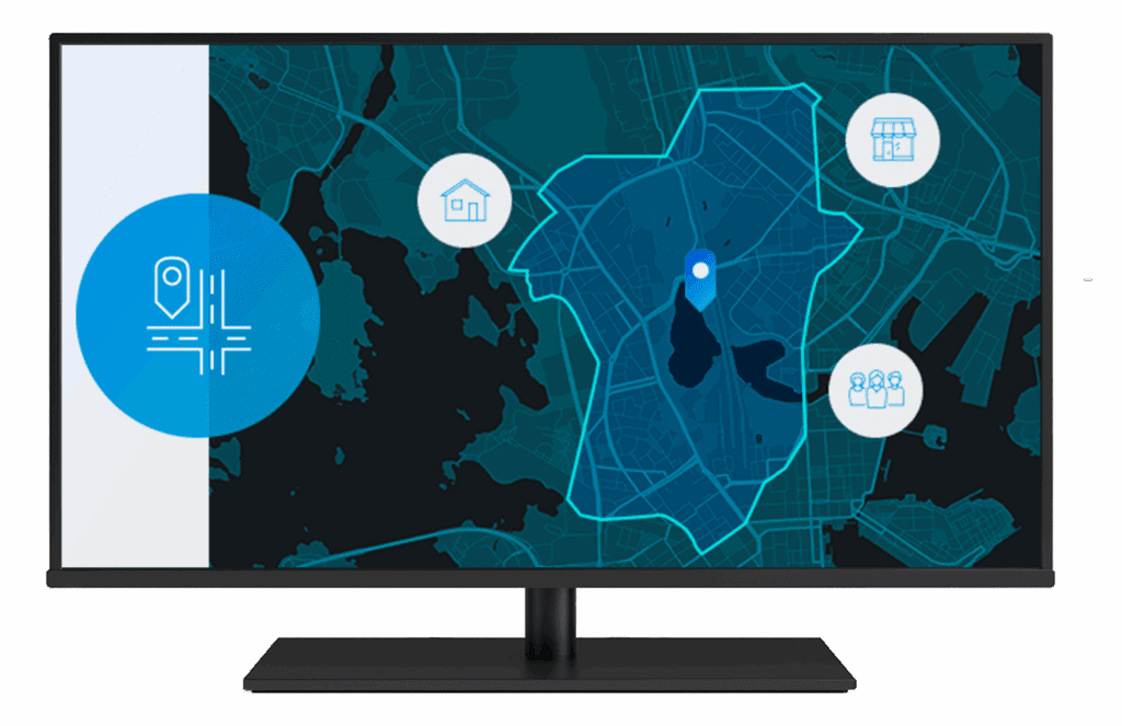
Site Selection

Finding the best site location for your business.

Site Selection Esri South Africa

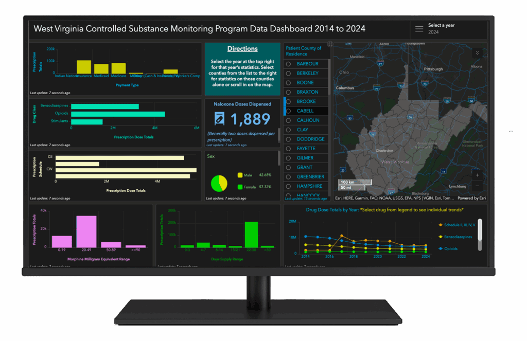
Site selection is the process of evaluating and choosing the most suitable location for a specific purpose, such as a business operation or development project. This process involves a comprehensive assessment of various factors to ensure the chosen site aligns with organisational mandates, operational needs, and strategic objectives. The goal of site selection is to optimise operations, minimise risks, and maximise long-term success by aligning the location with strategic and operational priorities. Site selection tools such as ArcGIS Online is often employed in this process to provide spatial analysis and data visualisation, enhancing decision-making.

Why use Site Selection?

The value of site selection lies in its ability to identify optimal locations that align with strategic goals, optimise operations, and minimise risks. By leveraging comprehensive data analysis and tools like GIS, the process provides actionable insights into market potential, cost efficiency, accessibility, and sustainability.

This ensures businesses maximise returns, enhance customer and employee satisfaction, and position themselves for long-term growth and adaptability in a competitive landscape.

Optimised Operations
Informed Decision-Making
Cost Efficiency
Enhanced Customer Access
Employee Satisfaction and Retention
Regulatory Compliance and Sustainability
Scalability and Growth
Optimised Operations
Informed Decision-Making
Cost Efficiency
Enhanced Customer Access
Employee Satisfaction and Retention
Regulatory Compliance and Sustainability
Scalability and Growth

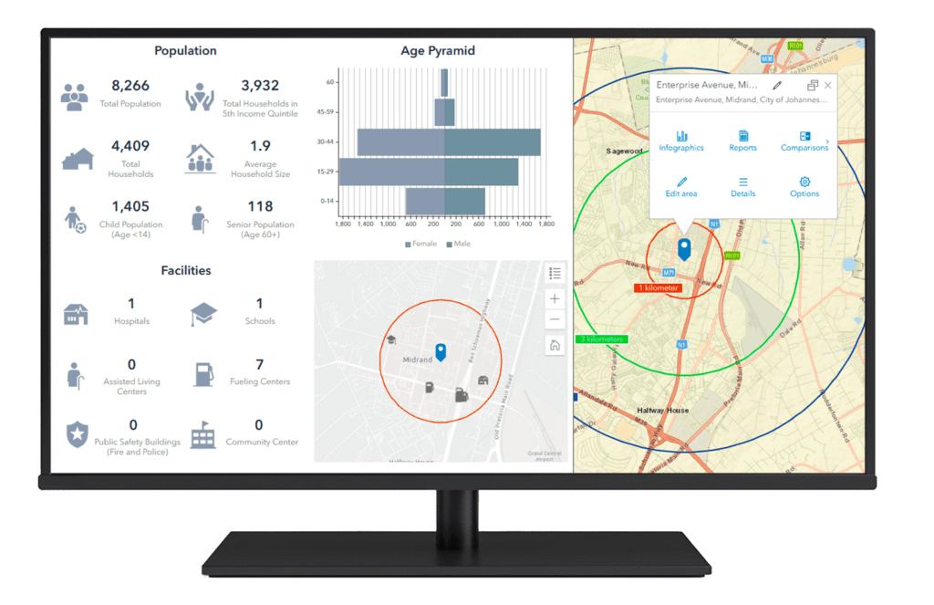
Spatial Data Integration

Combine diverse datasets (demographics, infrastructure, land use, etc.) into a single platform for a holistic view of potential sites.

Location Suitability Analysis

Ensures proximity to key markets, suppliers, and infrastructure, reducing transportation costs and improving supply chain efficiency.

Advanced Visualisation

Use maps and interactive dashboards to visualize site options and surrounding environments for better decision-making.

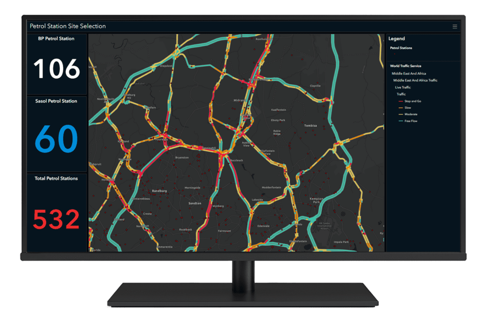
Proximity and Accessibility Analysis

Evaluate transportation networks, commute times (such as service areas/drive times), and distances to key facilities such as suppliers, customers, or amenities.

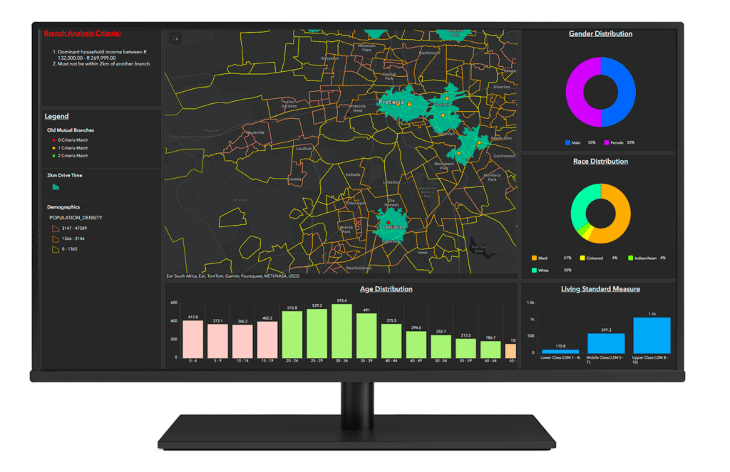
Demographic and Market Analysis

Analyse population data, income levels, spending habits, and market trends to assess the potential of a site to meet business or project objectives.

Environmental Impact Assessment

Examine topography, climate, natural hazards, and environmental constraints to minimize risks and ensure sustainability.

Scenario Modelling and What-If Analysis

Simulate different scenarios based on factors like population growth (i.e urban sprawl/decay) , infrastructure expansion, or market changes to future-proof site selection decisions.

Competitive and Risk Analysis

Map competitors, assess market saturation, and evaluate risks such as crime rates (crime stats) or natural disasters for each site.

Customizable Decision Frameworks

Develop weighted models to prioritize specific criteria, allowing organizations to tailor the site selection process to their unique goals.

Collaboration and Stakeholder Engagement

Share interactive maps and reports with stakeholders to improve communication and transparency.

Site Selection as a tool for decision making

A GIS-based site selection solution optimises the process by integrating spatial data, advanced analytics, and visualisation tools to identify optimal locations. It begins by defining objectives and gathering diverse datasets, such as demographics, infrastructure, and environmental factors, to name a few.

Using the ArcGIS suite of software, suitability models and proximity analyses are conducted, visualising results through interactive maps and dashboards. The solution supports scenario simulations and collaborative decision-making, enabling stakeholders to evaluate sites based on strategic goals. It delivers actionable insights and implementation plans, ensuring data-driven, sustainable, and future-proof site selection decisions.

Understanding Objectives & RequirementsData Collection & IntegrationGIS Tools & TechnologyAnalyticsCollaborative Decision-Making

Understanding Objectives & Requirements

• Collaborate with stakeholders to define goals (e.g., market expansion, operational efficiency, cost reduction).
• Identify critical criteria such as location proximity, demographics, environmental factors, and infrastructure needs.

Data Collection

Data Collection & Integration

• Data Sources: Demographics (population, income, consumer behaviour); infrastructure (roads, utilities, public transport); environmental data (topography, climate, protected areas); Points of Interest (competitors, hospitals, schools etc.); client’s own insights (Business metrics such as competition, market trends, profit/sales).
• GIS Integration: Aggregate data from various sources for seamless analysis.

Site Selection

GIS Tools & Technology

• Geographic Analysis: Use tools like ArcGIS Pro for spatial analysis and mapping.
• Suitability Modeling: Build models using weighted criteria to identify and rank suitable locations.
• Data Visualisation: Create interactive maps, heatmaps, and dashboards to present findings.
• Scenario Simulation: Test different scenarios (e.g., market expansion, population growth) to future-proof site selection.

Data Analytics

Analytics

• Proximity Analysis: Measure distances to markets, suppliers, and transport hubs.
• Demographic Analysis: Evaluate target customer base and workforce availability.
• Environmental Impact Assessment: Analyse risks like flooding, hail, or fire constraints.

Collaborative Decision-Making

• Develop intuitive dashboards (e.g., ArcGIS Dashboards) to share insights with stakeholders.
• Enable real-time collaboration using web-based GIS applications.

Site Selection as a tool for decision making

Understanding Objectives & RequirementsData Collection & IntegrationGIS Tools & TechnologyAnalyticsCollaborative Decision-Making

Understanding Objectives & Requirements

• Collaborate with stakeholders to define goals (e.g., market expansion, operational efficiency, cost reduction).

• Identify critical criteria such as location proximity, demographics, environmental factors, and infrastructure needs.

Data Collection

Data Collection & Integration

• Data Sources: Demographics (population, income, consumer behaviour); infrastructure (roads, utilities, public transport); environmental data (topography, climate, protected areas); Points of Interest (competitors, hospitals, schools etc.); client’s own insights (Business metrics such as competition, market trends, profit/sales).
• GIS Integration: Aggregate data from various sources for seamless analysis.

Site Selection

GIS Tools & Technology

• Geographic Analysis: Use tools like ArcGIS Pro for spatial analysis and mapping.
• Suitability Modeling: Build models using weighted criteria to identify and rank suitable locations.
• Data Visualisation: Create interactive maps, heatmaps, and dashboards to present findings.
• Scenario Simulation: Test different scenarios (e.g., market expansion, population growth) to future-proof site selection.

Date Analytics

Analytics

• Proximity Analysis: Measure distances to markets, suppliers, and transport hubs.
• Demographic Analysis: Evaluate target customer base and workforce availability.
• Environmental Impact Assessment: Analyse risks like flooding, hail, or fire constraints.

Collaborative Decision-Making

• Develop intuitive dashboards (e.g., ArcGIS Dashboards) to share insights with stakeholders.
• Enable real-time collaboration using web-based GIS applications.

Related Content

Contact Us


Contact

Give Us a Call

+27 11 238 6300

Email

General Enquiries

[email protected]

Technical Support

[email protected]

Scroll to Top