Telecommunications
A Complete GIS
Digitally Transforming Telecommunications Through Location Intelligence

Network Operations &
Maintenance
GIS optimizes resource & network optimization unifies OSS/BSS through a common understanding of location. Enhances real-time situational awareness.
Sales &
Marketing
GIS ensures higher return on investment (ROI) and revenue growth. Locate new opportunities and upsell potential with spatial analytics.
Customer
Service
GIS improves customer service. Located based customer sentiment reporting. Engage customers with mapping and visualizations.
Planning &
Engineering
GIS supports 5G, fiber, and software defined network (SDN) rollouts. Support remote engineering with geospatial planning tools and geographic data. One complete system to manage network planning, fulfillment, and assurance.
Information Technology
& New Services
GIS enables innovative products and services. Location based services and mapping make IoT come to life.
Resources
Putting Geospatial in 5G
Everything in telecommunications happens somewhere. As the world leader in location technology, Esri provides the most advanced capabilities in the industry. The enterprise GIS solution platform merges with major partner networks to help you stay ahead.

5G Geospatial Whitepaper
New technologies such as self-driving cars, edge computing and the Internet of Things (IoT) increase the need for high-bandwidth, low-latency networks. With 5G comes a never before seen dependency on location. In today’s broadband economy, geospatial technology matters more. Download here.

Location for Telecommunication E-book
Location intelligence is fundamental to all communication services—mobile and fixed, residential and enterprise. Esri’s ArcGIS is a complete GIS for telecommunications that empowers all aspects of an organization with geospatial infrastructure powered by the Esri Geospatial Cloud. Download here.
Digital Transformation

Field Operations
Take the power of location anywhere
Location Analytics
Analyse location of data on maps
Mapping
Bring your data into a map & discover spatial relationships
Real-Time Visualisation and Analytics
Make sense of real-time & big data
Digital Transformation
Field Operations
Take the power of location anywhere
Optimise efficiency in field activities with the power of location intelligence.
Mapping
Bring your data into a map & discover spatial relationships
Software to visualise and understand your data spatially.
Location Analytics
Analyse location of data on maps
ArcGIS uses location analytics to help you know what to do, when, and where. Map data to understand it, find patterns you couldn’t see before. No matter what kind of data you have, you can analyze it using ArcGIS.
Real-Time Visualisation and Analytics
Make sense of real-time & big data
Gain insights into real-time and big data through location intelligence.
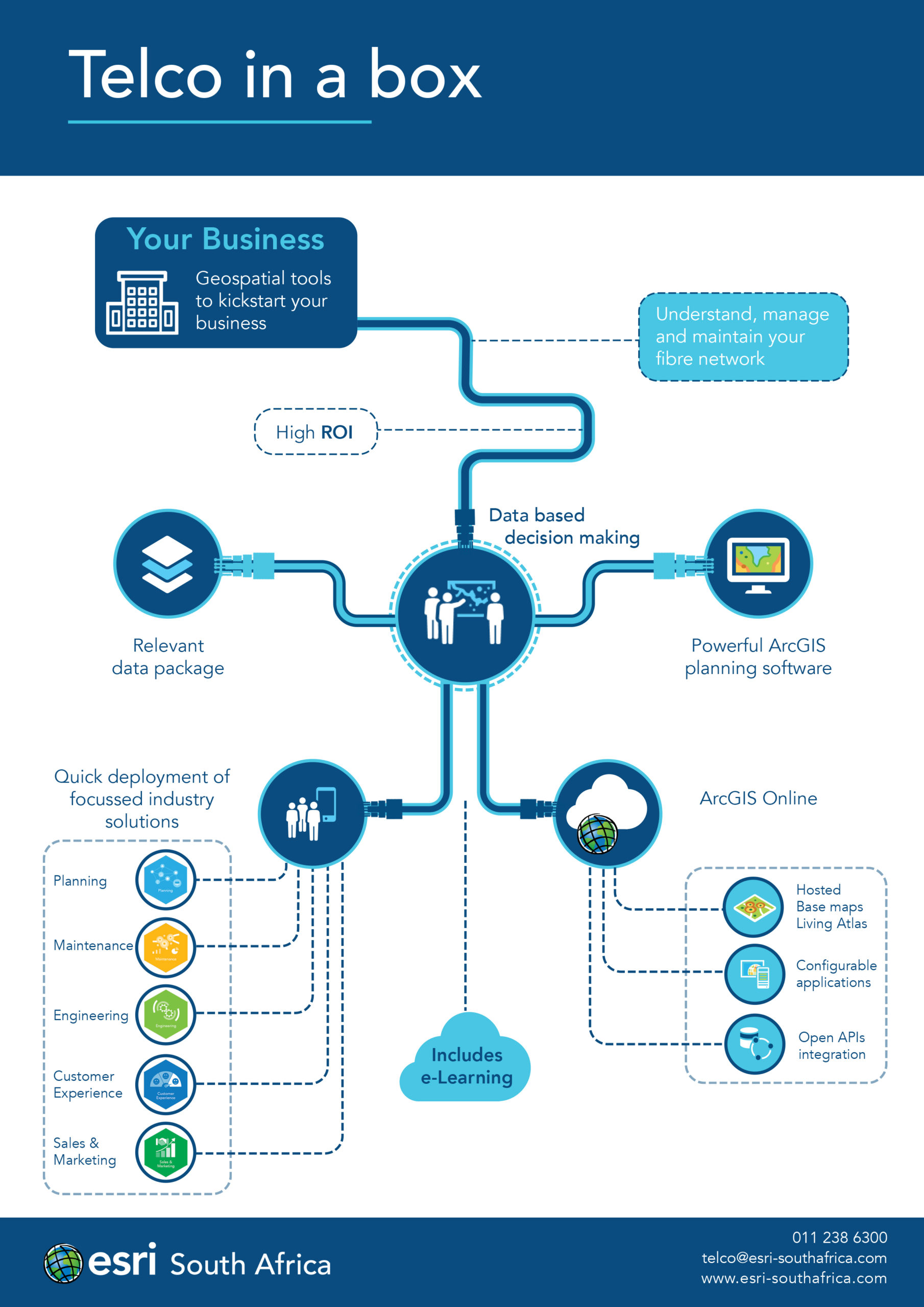
Telco in a box
Telco in a box is an affordable entry level product for small telecommunication planning offices. It offers a powerful combination of ArcGIS Desktop planning tools and a plethora configurable web and field applications to streamline your office to field network planning.


